Day 4: Santarém->Monsanto

https://www.mapmyfitness.com/workout/8173651519

Santarém sits on a defensible hill, surrounded by walls and natural bluffs that have protected it through centuries of conflict between the Moors, Romans, Portuguese, and others. It was the perfect spot for a layover.

Today, we picked up the Camino again. For the past few days, we’ve been following both the Camino de Santiago (yellow arrows) and the Camino de Fátima (blue arrows). Now, the paths diverge, and we’ll be following the blue arrows.

Today’s journey is 35 kilometers, taking us to the town of Monsanto, and for the first time, we encountered some real trails and hills. The morning started off with perfect hiking weather, gradually warming up to the mid-70s. Without much shade, it felt hotter, but still manageable.

The first 24 kilometers were mostly asphalt, and the last stretch, about 8 kilometers, led us through oak and eucalyptus forests. We tackled two climbs, each about 250 meters of elevation over 2-3 kilometers. The terrain was rocky and challenging, with loose stones and narrow passages through chaparral. It was tough but worth it—though the views from the top were hidden by fog, which, in a way, was a blessing, offering a cool break from the heat.

We passed rolling hills and farms, with bell peppers growing all around. I couldn’t resist grabbing one—it was juicy and delicious. Fresh produce straight from the source is unbeatable. We also came across fig trees, their sweet aroma inviting us to pick and enjoy them. Naturally, I obliged.

Around the 32-kilometer mark, I made a sudden turn and started heading down the hill we had been climbing. Tio wasn’t thrilled, but I had a good reason: there was a river below with a dam, a swimming hole, and picnic tables. I was determined to take a dip and cool off.

Normally, I might not have done this, but for the last six weeks, I’d been swimming with a friend in our local river, and the thought of jumping into this one was too tempting. The water was crystal clear, and we could see trout and whitefish swimming around us. The cold felt amazing on our legs after such a long walk. After drying off, we climbed back up the hill and continued to Monsanto.

Our albergue for the night was in a clock tower, where we were frequently reminded of the time—mostly because the clock needed resetting to be accurate! Thankfully, the bells weren’t loud enough to wake us, but if we were already awake, they definitely made themselves heard.

Day 3: Santarém

Normally, the walk from Lisbon to Santarém takes about three days and covers 90 kilometers. However, the first few days on any Camino tend to be the hardest as your body gets used to the physical demands of the trek. While that was a consideration, the main reason we decided to skip ahead a day was because of the wildfire smoke and heat. Even though the plumes were high, the smell of smoke filled the air, which meant there were particulates floating around. And honestly, I’d rather not be breathing in toxic air while hiking in the heat!

Instead, we took the opportunity to enjoy a rest day in Santarém and explore the town. It’s a lively place thanks to the polytechnic college, though the population is only around 30,000. We wandered around, ate some great food, checked off a few chores, and just enjoyed the rhythm of the day. It was a good, laid-back day.

Day 2: Camino de Fatima/Santiago

https://www.mapmyfitness.com/workout/8168925535https://www.mapmyfitness.com/workout/8168925535

The forecast for Day Two was in the low 90s. We had two options: a 20km hike or a 34km one. We decided to keep our plans flexible.

The route from Vila Franca da Xira to Azambuja was 20km, mostly on asphalt—probably 70-80%—with the rest on dirt roads. It was completely flat and entirely exposed, with no shade.

The day started off cool, around 68°F, but the heat quickly ramped up. At about 16km into the hike, we considered pushing on to the next albergue, another 13km away, since we were feeling pretty good. But then the heat really hit, and before I knew it, Luis Armando was out of sight. At the edge of Azambuja, I found a small patch of shade near some bamboo and waited for him. When he caught up, we both realized we were exhausted from the heat. Since it was still early and the albergue wasn’t open yet, we decided to grab lunch. Unfortunately, the flies were all over the tuna lasagna, making the meal less than enjoyable, but I ate what I could.

Throughout the day, every place we stopped had the TV on, showing news of wildfires about 150-200km to the north. Though the fires were far from us, we could smell the smoke as the plume passed overhead.

With the high temperatures, smoke in the air, and more heat forecast for the following day, we decided to take the train to Santarém, giving ourselves a rest day to do laundry and explore the town.

On the train, I managed to find some seats, facing three ladies who seemed to be enjoying their peaceful ride. As I hoisted my pack up to the overhead storage, disaster struck—my water bottle slipped out, and wouldn’t you know it, it smacked one of them right on the knee before bouncing to the floor.

In a heroic attempt to help, she bent down to pick it up. Unfortunately, what neither of us realized was that the top had broken during the fall, and the bottle was now basically an open faucet. Water sprayed everywhere—on her, on me, and all over the seats I had just claimed.

Luis Armando, blissfully unaware of the chaos, turned around just in time to witness the aftermath—the confusion, the soaked seats, and the ladies trying not to laugh. That was it, the perfect icebreaker. Soon, we were deep in conversation with the three women, who, it turned out, were elementary school teachers heading home to Santarém after a long day at work.

What started as a water bottle disaster ended up as the beginning of a delightful chat. It’s funny how a little chaos can bring people together!

Day 1: Camino de Fatima/Santiago

https://www.mapmyfitness.com/workout/8167208539


Lisbon to Vila Franca da Xira

Leaving Lisbon for the first stage is always tough. If you choose to hike it, it’s an 8-12km stretch through some rough parts of the city and industrial areas. I’ve done it before and wasn’t keen on doing it again, especially with the forecast calling for 95°F and the entire stage being 34km. So, we decided to take the train to Sacavém, where a new pedestrian bridge has been built since I last walked this route. As a result, much of today’s walk was new to me.

This stage doesn’t pass through many towns but instead follows a 22km boardwalk and gravel trail through wetlands, where we saw an abundance of waterfowl.

We arrived in Vila Franca da Xira without any issues, though we were completely exhausted from the heat after covering 28km.


Exploring Lisbon


The direct flight from San Francisco to Lisboa was smooth and straightforward. I was only carrying a 10kg backpack, which seemed to surprise the gate agents. The plane was packed, with just a couple of babies who occasionally got fussy. Interestingly, the mom and kids were in economy while the dad was seated in first class. He only came back to let the mom take a bathroom break. Go figure…

I arrived in Lisbon three hours before Luis Armando, so I spent that time people-watching, always a fun way to pass the time. Once Luis Armando arrived, we took the metro, and 30 easy minutes later, we were at our hostel, the Lisbon Lounge.

The city was alive with a mix of languages, though most conversations were in either English or Spanish. We met travelers from Latin America—Mexico, Guatemala, Argentina, Colombia, Bolivia—as well as people from France, Ukraine, the U.S., and Spain. Most were in their 20s to 40s, but there were also retirees and younger students adding to the diversity.

Day 1: Alfama and the Castle of San Jorge

On our first day, we explored Alfama, famous for its food, architecture, and the iconic Castle of San Jorge. Walking up to the castle was a great way to stretch our legs after the long flight. The buildings were adorned with Moorish tiles, and the streets were made of smooth cobblestones. If walking wasn’t your thing, the trolley system was always an option to get up the hill.

The Castle of San Jorge is a beautifully preserved example of Moorish architecture. It’s a reminder of the violence humans have inflicted on each other over the centuries, though it’s hard to believe we now live in a much more peaceful world.

Lisbon, with its bay and the river Tejo, reminded me of San Francisco. Crossing the river is a suspension bridge, much like the Golden Gate. The weather is warmer, but the ecosystem is surprisingly similar—oak forests and golden rolling hills.

Day 2: Sintra

On our second day, we left early for Sintra, the former summer retreat of Portuguese royalty. Built on a mountain, Sintra is home to forests, castles, palaces, and lush gardens.

A 40-minute train ride took us up about 500 feet to the town of Sintra, which reminded me of Taxco, Mexico—an ancient town clinging to a steep mountainside. We walked 2.5 miles from the train station, gaining another 1,000 feet in elevation, and explored hidden gardens, rock formations, secret homes tucked away from palace life, and forests filled with trees from around the world—including giant sequoias and coastal redwoods from Oregon and California, some 200-300 years old.

The Palacio da Pena is incredibly popular, and entry times are strictly controlled. We arrived at 9:30 am and found the line manageable, though once inside, the palace was crowded, making it hard to take in all the details. The palace is a blend of architectural styles—Moorish, monastic, and royal—each era leaving its mark on the structure. The grandeur was overwhelming, though, as expected, there was little mention of the people who kept it all running behind the scenes.

After leaving the palace, we wandered down through the forest, taking in the serene beauty of the surroundings. I got a bit carried away, choosing the scenic path at every turn, which extended our walk a little longer than planned. By the time we reached the town for lunch, around 11:30, the restaurants hadn’t opened yet, but the wait was worth it. I had bacalhau (codfish) baked to a crisp in a slightly sweet glaze—easily the best meal I’ve had in Portugal so far.

In the afternoon, we explored a whimsical four-hectare garden created by an eccentric man who loved rituals and games. The garden was filled with wells and rock formations concealing secret entrances to tunnels. You could disappear around a corner and end up in a Templar ritual site or evade prying eyes while sneaking off with your buddies.

Despite the number of visitors, the garden felt peaceful, filled with birdsong and the sounds of the forest. The only real lines were at the entrance and for the most famous attraction—a spiral staircase that descends into the earth, connecting with the underground tunnel system.

Day 3: E-Scooters to Belém

For our final day, we decided to head to Belém, about 10-12km from Lisbon, along the coast. Instead of taking the metro or trolley, we opted for e-scooters. After a thrilling 40-minute ride, we arrived at the Monument to Vasco da Gama, who set sail from here in search of a westward route to India, accidentally discovering Brazil along the way. The monument is a modern, concrete structure vaguely resembling a ship’s bow, with Vasco da Gama and his crew looking out toward the unknown.

[EDIT: I have been corrected and educated by a wonderful waitress.

Portuguese explorer Pedro Álvares Cabral was the first European to discover Brazil on April 22, 1500. He landed on the coast of what is now the state of Bahia, claiming the territory for Portugal under the Treaty of Tordesillas, which divided newly discovered lands between Portugal and Spain. However, indigenous peoples had inhabited the region for thousands of years before the arrival of Europeans.]

Our next stop was a small fortress on the riverfront, built to defend Lisbon. Unfortunately, when the time came, it fell to the Spanish in just a few hours.

Finally, we visited the monastery where Vasco da Gama’s remains are buried. The line to enter was wrapped around the block, so we chose to visit the Maritime Museum instead. It’s clear that the Portuguese are immensely proud of their history of exploration and colonization, though there’s little mention of the darker aspects, like slavery and oppression. It reminded me of how Spain and the U.S. often gloss over similar parts of their histories.


In Memory of my Sister-In-Law

When I started walking the caminos back in 2015, I had no idea that it was a life-long dream of my sister-in-law to also walk the Camino. She was a person of great faith and followed me through my journeys as she was unable to walk a Camino herself. As I happened upon religious sites and events on the various Caminos, she would want to know all about them and my experiences. This is one very personal thing that we shared together, even though our faith and belief in God couldn’t be more different.

For 17 years, she fought with cancer. This past June, her suffering ended as she passed away. Her husband and I will be traveling this year in her memory and taking a lock of her hair along with us. We will attempt to get a Compostela in her name. Because of her strong faith, we decided to take the Portuguese route from Lisboa to Fatima so that she could be present in spirit there with us. We will then continue on the Camino to Santiago, and then on to Muxia and Finestere. It will be a mixed trip of walking and bus travel due to available time.

This year you ask? When exactly? Well, we leave on Wednesday, September 11th. Many people have asked for me to write about the journey. I wrote about my Camino this past April, but I did not publish it. Because there are two of us, and we will be sharing with family, I expect to post fairly often on this trip.

Stay tuned…

Camino Tech

I’m a techie… been in IT for almost 40 years now. Tracking stats, maps, and things are all fun things for me. They aren’t for everyone, and that’s OK. Everyone has their own Camino and one is no better than another. I have always used tech on my Caminos. Researching, mapping, GPS tracks, health and distance stats, etc. Many ask which tools to use, and there are as many tools and ways to use them as there are Caminos. But here’s what I have used and what I like…

Fitness Tracker

I use an iPhone 13 Plus and Apple Watch Ultra 2. They just work. I particularly like that all of my files, photos, and information I use on a day-to-day basis is automatically backed up to the cloud and synced on all of my devices. If I lose my phone, I haven’t lost any data, and I can be up and running as soon as I replace it. The one thing I don’t like about my Apple Watch is that if its misting outside, or because I am a surdo (left-handed), buttons or the screen get pushed/tapped and stop my workouts and tracking. I have just recently found a way to overrule this – put the watch in “Water Lock” mode where it locks the screen and buttons so they can’t be inadvertently tapped or pushed. I think this will solve my problem.

Mapping Software

Gaia Pro

MapMyFitness

As for software for fitness tracking, I use MapMyFitness by Underarmor. I have used many others, but have settled on MapMyFitness. There’s not really anything I like about it more than the others, they are all underwhelming – that is to say, I haven’t found anything better about any of the others to make me want to change and lose my history, or have to migrate my history.

For generic mapping software, I use GaiaPro. This is a pretty advanced application that has a myriad of map styles and sources to choose from. There are even base hiking maps with the Camino routes already on them. Standard features are routing, off-line maps, route tracking, photo insertion, etc. I also use it for other things like my CritterCam projects with the California State Parks.

Gronze.Com

Gronze.com is an online mapping tool that is specific to the Camino. It’s in Spanish/Castellano, and has the official routes documented. I primarily use it for the other information it contains, which I will talk about later.

Google Maps. I use google maps whenever I am overseas, as I find that it has the best/most accurate database of businesses, transit, etc. that I might need while I am traveling. I like Apple Maps better, but it’s not as good as Google Maps overseas.

WikiLoc

Wikiloc – this is similar to All Trails, but it’s more widely used in Europe than All Trails – or seems to be. This is both good and bad. There are sooooo many trails that have been uploaded by so many people, it’s difficult to filter just what you need. You can download routes to your phone and watch if you want to do that. But for routing, I like to put my devices on mute and route by the yellow arrows. While I like tech, I’m working on being present more…

Camino Specific Apps

Gronze.com is a Spanish Language site that has detailed information on most Camino routes including albergues, places to eat and get supplies, history, route steps and information, attractions, etc. It seems endless the amount of information they have. Very useful. My main gripe about Gronze.com is that it’s not an app. You have to have internet access and it can be hard/slow to navigate on a small screen. But the amount of information available is probably the best of the apps I’ve been exposed to.

Wise Pilgrim

Wise Pilgrim Apps (one for each route). This is a great set of tools. They offer much of the same information as Gronze.com, but it’s in an app, offline, and in English. It’s quick to navigate and they have done a really good job at improving it over the years.

These tools provide trail profiles, details about which trails and services are open/closed, and they also provide a forum where users can post updates which WP can incorporate into their database.

Transportation

Don’t forget transportation and how to get around. Google Maps is a good starting place, but I quickly found that it was inaccurate and incomplete. I have yet to find a complete tool that encompasses most forms of transportation in Spain. I have, however, downloaded BlaBlaCar -again-. In 2015, I took a ride share from Madrid to Pamplona and it cost me something like €12. A bus ride from Bilbao to Bayona, Fr, on Google Maps was going to take 4-6 hours and cost €40. On Uber it was going to be something like €350. On BlaBlaCar, it cost €5.99 and will take 2hr 20min on a bus. There are other transport apps like RENFE (train), Alsa (bus), etc, but those are sometimes hard to navigate if you don’t know the exact stations you need to be at/go to.

Caveat

You always have to have a caveat as there are those people who like to argue and insert their toxicity behind the anonymity of the internet. These are only some of the tools I have used, and the ones I am taking on my trip this year. If I find others, I will look at them. Tools that I have used in previous years are no longer on my phone as I found these work better for me. Make your Camino your own, find the tools that work best for you.

A list of my Caminos

Each Camino is different. They offer different climates, cultures, food, terrain, history, etc. The Camino Frances, which is the best known of the published routes, runs for about 790km and has mountains, plains, forest, cities and towns, single track to asphalt. It also offers arguably the most flexible route as far as the frequency and distance between places to stay and eat. It is a beautiful route, but because it is the most widely known route, it’s not my preference. Not that I wouldn’t walk it again, but there is so much more to see, that I would prefer walking other routes over this one.

On the opposite, is the Camino Olvidado. It runs between Bilbao and Ponferrada (Camino Frances) for 489km and is some of the most remote paths that I have encountered to-date. Many towns do not have complete services and many albergues are sporadically closed. One must plan to walk this route and you would be luck to encounter another pilgrim. It is a solitary trail, but offers some of the most beautiful countryside of any of the caminos.

My favorite so far has been the Camino Primitivo between Oviedo and Melide (Camino Frances) and runs 261km. This route has a nice blend of mountains, forests, rivers, villages and towns, and people. It is better known than the Camino Olvidado, so it has more services, but it is arguably more strenuous than the Camino Frances. It’s a good balance.

YearCaminoFromToDistanceTerrainPeople (Other pilgrims)
2015FrancesSaint Jean-Pied-de-PortSantiago790kmMountain, plains, forest100’s per day
2016NorteSan SebastianSantander245kmCostal, Mountains15-30 per day
2016PrimitivoOviedoMelide/Santiago311kmMountains, forest, farmsTypically no more than 20 per day
2017Portugues (Costal)LisbonSantiago630kmMountains, Oak Savana, costal, cities & towns20-40 per day
2022OlvidadoBilbaoPonferrada475kmMountains, forests, farms<10 entire route (three when I did it)
2022InviernoPonferradaSantiago260kmMountains, forests, rivers, towns10-15 per day
2024My Custom Route (Norte->Vadiense->Olvidado->Salvador->Primitivo->Frances)Bayona->Comillas->Cistierna->La Robla->Oviedo->Melide->SantiagoSantiago1006kmAll of the aboveAll of the above
My Routes and Overview
My Caminos

Camino de Santiago 2024

This year I will embark on yet another Camino walk. This will be my fifth time there, and walking six different routes this year. This year will also be my longest walk exceeding 1000km or 600 miles. About half of this year’s route will be new to me, and the other half, will be on previously walked trails.

The Camino is a unique experience, even between companions, each one will have a different experience, challenges, and take-aways. There is a saying on the Camino: Your camino starts when you reach Santiago. The tomb Santiago or Saint James of course being the typical destination, located in the north-western corner of Spain, in Galicia, in the city of Santiago de Compostela. The most known route is the Camino Frances which runs from Saint-Jean-Pied-de-Port in the south western part of France, and travels 790km to Santiago. This was my first Camino in 2015. I physically suffered during this Camino, but I got hooked, and returned to walk the Camino Norte and Camino Primitivo in 2017, then the Camino Portuguese in 2017, and then the Camino Olvidado in 2022.

This year, I will start in Bayona France, and walk the Camino Norte along the cost of the Bay of Biscay for 16 days. Of these 16 days, six will be new to me. After the 16 days, I will then head south and cross the Cantabrian Mountains on the Camino Vadiniense – all new to me – for eight days. I then connect to the Camino Olvidado in Cistern for two days – which I have walked before, and then head north for five days on the Camino Salvador – new to me – to once again cross the Cantabrian Mountains to the city of Oviedo. From Oviedo, I head south west to cross the Cantabrian Mountains one more time on the Camino Primitivo for 11 days (I’ve walked this route before), and then finally in the town of Melide, I connect with the Camino Frances for the final three days. That’s a total of 45 days on the trail, and lots of coast, but mostly mountains. The route is roughly the neon green highlighted in the map below.

I plan to share my journal on this blog of this Camino as I have shared other adventures. I leave California on April 24th and will start walking a few days later. Feel free to ask questions, and share the blog to anyone who might be interested.

As we say on the Camino… Buen Camino!

Post Adventure Thoughts

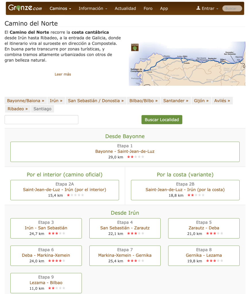
I have been back for just shy of four weeks now and usually when I travel, I have some type of “culture shock” or revelations. In this case they are revelations. These are mostly comparisons between Mexico and the United States. They are also similar to what I have experienced in the past coming back to the US.

Police Corruption – it’s present, but not the norm

While we got stopped several times by the myriad of different types of police in Mexico, I was actually only harassed one time. Yes it was stressful, but I got out unscathed. I was warned about the police in this town and their ties to the cartels, so it’s not surprising.

What is important to note, is that on our last day in Mexico, traveling from Saltillo to Eagle Pass, TX, we pulled out of our hotel, but there were large orange cones in the driveway. These can mean anything in Mexico, so I simply had them moved and we drove onto the boulevard in front of the hotel. Except that it was crowded with pedestrians, joggers, and cyclists. Evidently, they close many roads every Sunday to traffic and let the people “own” the streets and use them for exercise and just getting out without having to worry about the traffic. A novel idea.

It was closed however, and as I was turning right to get off the boulevard at the first intersection, I got waived down by a young police officer. I knew this could be problematic, so I preemptively opened my window and before he had a chance to say anything, I greeted him and asked him how to get off this boulevard and explained the situation. He asked for my license, told me what I already knew and then told me to pull over to the street I was already turning onto. After about 5-10 minutes, he said he needed to give me a ticket, but it was obvious he didn’t really want to, so I asked to talk with his supervisor. About 10 minutes later his supervisor pulled up in a pickup truck and I got out and talked with him for another 10 minutes. Again taking the initiative to state the obvious, then I asked him if he could escort us out of the city as we couldn’t wait for the road to open as we had an appointment with Banjercito at the border for paperwork. He too stated he should give us a ticket, but then I asked again for an escort and he obliged. Escorting us about five miles to where there would be no more road closures, he turned around and waived us on.

In our travel stories, we don’t talk about the good interactions with police too much, but every other interaction I had with them, whether it be on the street walking and asking for directions, asking for questions about their town, or being stopped for standard inspections – was a positive experience. They are there just doing their jobs.

I got harassed only once out of the twenty or so interactions I had with the police in Mexico. The one time I got harassed, it was in a known cartel collusion area, I was warned, and I was driving a foreign vehicle. In the end, they let me go my way without any issues other than 60-90 minute delay in my day, and it really didn’t impact me other than the time I was stopped.

So, while we are warned and talk about police corruption in Mexico, and it most definitely is present, they are in the minority and most police officers are just doing their job and are happy to talk to/with you. They are people too.

Mexican vs US Drivers

In Mexico, driving has you on your toes. I wouldn’t say it’s dangerous, and from my anecdotal experiences driving over 25,000 miles in Mexico over the years, I would venture to say that Mexican drivers are actually better drivers than those in the US. Here is why I have come to that conclusion:

In Mexico, you will encounter topes or speed bumps on every type of road from cul-de-sacs, to country lanes, to boulevards, to major national autopsists or toll roads. They can be anything from white lines painted on the road way causing vibrations to jolting six inch tall asphalt tire/suspension-destroying humps that are unmarked.

On the contrast, there are also potholes on every roadway in varying states of decay, depth, and diabolical properties that will give you spinal compression fractures as you are launched out of the pothole and back onto the roadway for a final suspension-misalignment treatment.

There are also the narrow (think country lane) two-lane highways that have no shoulder, but instead have a 5-500′ drop off on one side and immoveable trees encroaching on the highway so you can’t use the entire lane. As you encounter these narrow lanes, you must add the pot holes and topes. So you see oncoming traffic swerving all over the road in front of you playing chicken at 100-120 kph (60-70 MPH).

The speed limits are subjective. The reality is that the road conditions dictate the speed limit plus some. If you go any faster, you will destroy your car.

We also have animals to contend with… dogs, chickens, donkeys, horses, cows, etc. My favorite [sic] are the pigs in the trucks being taken to slaughter. The pack so many pig in the trucks with open siding (just barriers to keep them in) that you can smell the pig trucks for miles before you reach them to over take them. As you are over taking them my suggestion is to do so as the fastest speed possible (well beyond the safe speed for road conditions). The reason for this is that if you take your time in passing these trucks, of the 200-300 pigs on board, of the 10% or so that have their asses pointed to you, one of them will inevitably defecate or urinate all over your vehicle.

Back to the other animal hazards, they are usually not in pastures or tied up. So they roam the roads freely. After all, it’s easier to walk on a road than through rocks and brush. When they are tied up, they are tied up so close to the road, that they will often be laying down on the road and sleeping – until you get close then they will suddenly jump up and run to the end of their tether – in the middle of the road.

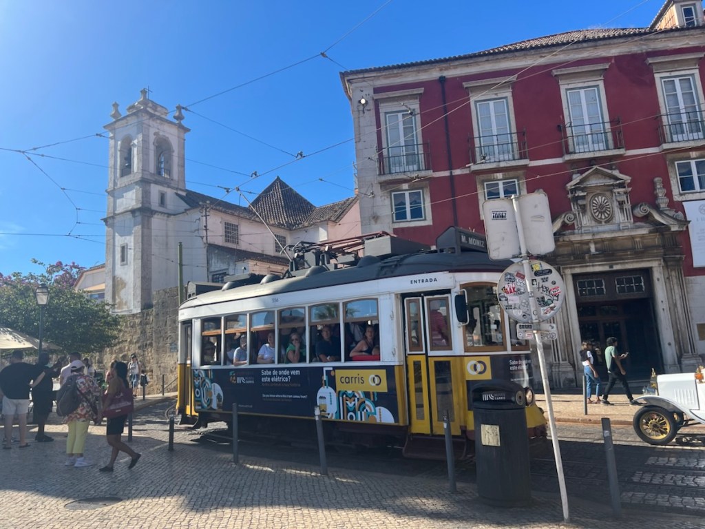
Now let’s get to city drivers… traffic lights – pshhh – who needs them. Painted lane lines on the street… pshhh, let’s make our own lanes… blind curves, narrow streets, topes, potholes, livestock… you get the picture.

Now here’s here it gets interesting. Mexicans learned how to drive in these conditions. They are ever-alter and rarely distracted with cell phones, eating in their cars, putting makeup on, shaving, reading, autonomous driving cars, etc. They are reactionary drivers and they are good at it. They take it in stride. For the most part, it’s all part of the commute and just another day.

Because Mexicans are reactionary, offensive, and then finally defensive drivers, they are good drivers. They know how to avoid accidents. In all of the miles we drove this past summer, we saw… TWO accident. The first was where a double gasoline trailer driver fell asleep and ran off the road into a muddy field. There were two tow trucks there trying to extricate it out of the field. The second one was bad, it was a single vehicle accident where the long haul truck driver… fell asleep and the truck went off of one of those aforementioned embankments, overturned and was completely destroyed. The local townspeople were there collecting free cans of Coke and doing the highway department a great service by cleaning up the mess.

In contrast, I have been back in the states for just under four weeks and I have seen countless accidents on the freeways and have only driven about 800 miles. The other thing I have seen is road-rage. People are angry… They want to take it out on anyone. A delivery van and Dodge Charger racing down the freeway weaving in between traffic, driving on the shoulder all because the Charger “cut the delivery driver off”

Because of all the strict traffic laws and the threat of citations, people in the US mostly obey the laws. Because of this, they have time to be distracted. They are on their phones, eating fast food, shaving, having their Teslas drive them, etc. They have forgotten how to drive. So when there’s something out of the norm, they don’t know how to react. The results are no reaction and an accident, or over reaction and an accident.

Because of this, I have come to my subjective conclusion that Mexican (and for similar reasons, most other countries in the world) are better drivers than those from the United States. We pretty much suck at driving. Even good drivers in the US are bad drivers in Mexico. We just don’t have the skillset to be reactive drivers and pay attention – it’s more important for us to answer that text, eat those fries, and put makeup on instead of driving.